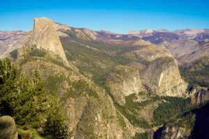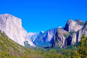
Taft Point is a viewpoint location that provides visitors with an astounding view of the Yosemite Valley and El Capitan. A popular photo opportunity is near the ledge (granted you’re not afraid of heights).
Contents
Directions
Arch Rock
From the Arch Rock entrance, head northeast on El Portal Rd and drive for 5.5 miles. El Portal Rd turns slightly right and becomes Southside Dr. (0.9 miles). In 9.2 miles, turn slightly right on CA-41 S/Wawona Rd. Turn left on Glacier Point Road and drive for 13 miles.
Big Oak Flat
From the Big Oak Flat entrance, head southeast on CA-120 E toward Tuolumne Grove Rd. and drive for 7.7 miles. Continue on to Old Yosemite Coulterville Rd and continue on to Big Oak Flat Road (9.5 miles). Turn left on El Portal Rd (signs for Yosemite Valley/CA-41/Fresno). El Portal Rd turns slightly right and becomes Southside Dr. (0.9 miles). In 9.2 miles, turn slightly right on CA-41 S/Wawona Rd. Turn left on Glacier Point Road and drive for 13 miles.
Hetch Hetchy
From the Hetch Hetchy entrance, take Evergreen Rd. to CA-120 E and drive for 8.7 miles. Follow CA-120 E, Big Oak Flat Road and Wawona Rd to Glacier Point Rd in Wawona (29.4 miles). Turn left on Glacier Point Road and drive for 13 miles.
South
From the South entrance, head northwest on CA-41. At the traffic circle, take the 2nd exit onto Wawona Rd (16.9 miles). Turn right on Glacier Point Rd and drive for 13 miles.
Tioga Pass
From the Tioga Pass Entrance, head south on CA-120 W toward Tioga Pass Parking Lot and drive for 46.5 miles. Turn left on Old Yosemite Coulterville Rd (signs for Yosemite Valley/CA-41/CA-140) and continue on to Big Oak Flat Road (9.5 miles). Turn left on El Portal Rd (signs for Yosemite Valley/CA-41/Fresno). El Portal Rd turns slightly right and becomes Southside Dr. (0.9 miles). In 9.2 miles, turn slightly right on CA-41 S/Wawona Rd. Turn left on Glacier Point Road and drive for 13 miles.
This is a map of Yosemite and where Taft Point is located.

Parking
There is a small parking lot with limited spots located on Glacier Road. If you are unable to park here, you can park on some shoulders nearby. During peak times, you might not be able to find parking so we suggest you take the free shuttle or arrive earlier (we went before sunrise).
Restrooms
There is one restroom stall in the parking lot but we are not sure how well maintained it is.
Distance
The hike to Taft Point is approximately 2 miles round trip.
Difficulty
This is an easy hike. Most trail reviews will rate this hike as easy due to its flat land with minimal elevation gain and uneven footing. However, when we went, we were walking at a faster pace than usual because we wanted to catch the sun rising.
Taft Point
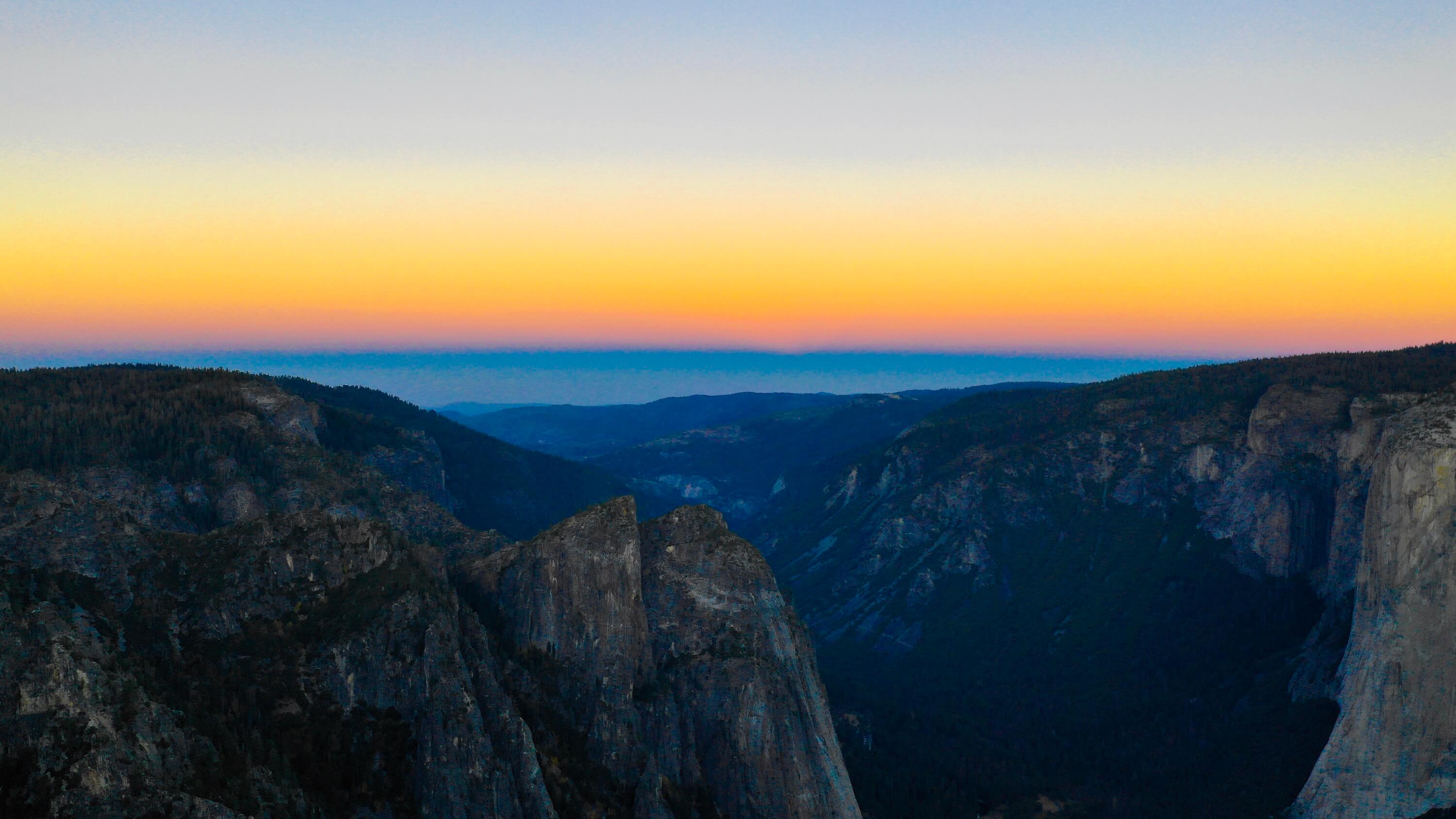
We arrived 45 minutes before sunrise and the trail was starting to light up with some sun. Since we were a little late, we had to rush through the trail following another set of hikers. You might have to use a flashlight if you are unable to see in the dim light (we used our phone flashlights).
There will be a sign with a fork in the road. Follow to your left to go to Taft Point. The right will take you to Sentinel Dome.

You will be walking in the woods with high trees for the majority of the trail. You’ll know you are close when you see a clearing with rocks.

As you walk to the edge of the cliff from the direction of the woods, keep walking to your left and Taft Point will be the middle of the cliffs.
There was a line rope for high rise walking but no one was using it at this time. It was already set up prior. We are unsure if it is always there or if it was there for the weekend.


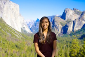
There are a couple of popular photo opportunities along the ledge of the cliffs. You might have to wait your turn for awhile if you come during a peak time for a picture. One of the pictures looks best if you can get closest to the ledge with the background of the mountains.


But be careful! It is very daunting. Brea would have loved a picture on the ledge but she couldn’t manage because she’s afraid of heights. So this was the closest she got.
Flying a drone in Yosemite is illegal but Brea flew her drone to catch the sun rising with a hyperlapse.


Places nearby
Glacier Point, Sentinel Dome, and Washburn Point
It was definitely worth waking up really early to see the sunrise over this view point. There were only 5 different groups of people at Taft Point when we arrived enjoying the view with us. You could easily get an unpopulated picture without having people breathe down your neck for their turn.
We wished we were the guy that set up a tent near the ledge so he was able to wake up to this view.
You are only allowed to camp at designated areas through. It is stated in the front entrance signs.